Continuing our journey along the backbone of the southern canal network, we pass through long tunnels and classic canal villages from Braunston to Marsworth…
At the end of the first part of our journey south eastwards from Birmingham to London along the canal which forms the backbone of the south Midlands waterways, we reached Napton Junction. Here, the canal that we’d been travelling on – which had historically been the Warwick & Napton Canal – met the earlier Oxford Canal at a T-juntion: turn right for the southern Oxford Canal leading to Oxford and the River Thames, or left for the northern Oxford Canal heading for Rugby and on into the Warwickshire coalfield that provided much of its traffic.

Left towards Rugby
But a little curiously given that our final destination is also the Thames, we take a left turn here – away from Oxford and towards Rugby. A glance at the map will explain this slight oddity: the next five miles of route are in effect shared by both the Grand Union and Oxford Canal routes, but with both of them doing a bit of a ‘wiggle’ so that the northbound Oxford forms the southbound Grand Union, and vice versa.
Well, when I say ‘forms’ – it’s actually still the Oxford Canal. It was built first, and its owners negotiated favourable terms in exchange for not opposing the construction of the newer and more direct links which form today’s Grand Union – including heavy tolls for through traffic passing along those five miles.
As far as cruising along it today is concerned, with its concrete piled banks, fairly generous channel width and wide bridges (dating from when it was enlarged to 14ft wide beam under the Grand Union modernisation programme in the early 1930s) it might seem like just another part of the Grand Union route. However its rather winding course is slightly more reminiscent of the southern Oxford – including in the first few miles a couple of main road bridges with blind bends either side: approach with caution.
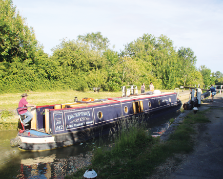
Take a right at Braunston Turn
A cutting and a straight embankment dating from when the Oxford Canal was straightened in the 1820s (some traces of the original roundabout route which included a short tunnel can still be found) lead to Braunston Turn. A fine pair of cast iron towpath bridges mark the junction where the Oxford Canal turns left and heads off northwards, while we take a right turn for the southern part of the Grand Union. Or, as it was until the 20th century amalgamations (and as the letters ‘G.J.C.Co.’ on the mileposts still testify), the Grand Junction Canal.
Opened in 1805, this was one of the longest canals built as a single entity (rather than formed by amalgamation) in Britain, reaching for just over 93 miles from Braunston to the Thames at Brentford. It’s opening lopped 60 miles off the distance from the Midlands to London when compared to the older route via the southern Oxford Canal, as well as avoiding the then unreliable River Thames navigation – and it put Braunston well and truly on the canal map…
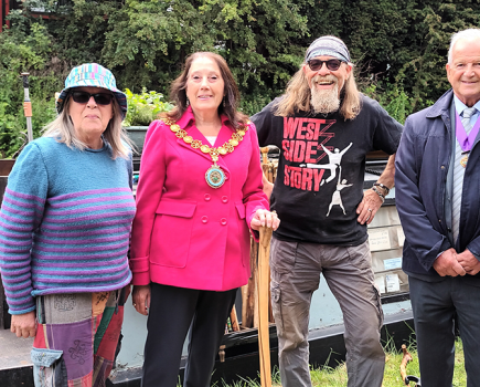
Braunston might be a small hill-top village that’s little-known (or even signposted) in non-canal circles beyond the immediate neighbourhood, but it’s the absolute heart of the region’s canal system – indeed it’s marked on the mileposts all the way from the Thames. An important junction, it was also akin to a home town for many of the travelling working boat families, who might well be married in the church (whose tall spire is visible to approaching boats from some distance), and buried in its churchyard. It was home to boatyards (wooden working boats were built there right up to the 1950s), and the base for some of the last carrying companies in the final years of trade.
Today it’s a busy boating centre for leisure craft (although there are always plenty of working boats to be seen too), with its marina, many boatyard businesses, and canal side pubs – and for one weekend a year Braunston turns back the clock for the Historic Narrowboat Rally, with the canal thronged with historic working craft for the daily parades in one of the waterways’ most atmospheric annual events.

Boats passing at the eastern portal of Braunston Tunnel
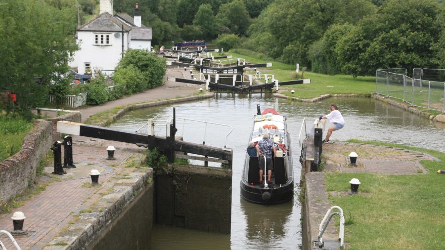
The Grand Junction Canal runs through the middle of all this, beginning its long journey to London by climbing the six Braunston Locks. Unlike those that we’ve seen on the trip from Birmingham with their modern enclosed gearing dating from the 1930s widening scheme, these have always been 14ft wide and are equipped with more traditional gear.
Through Braunston locks and Tunnel
It’s not far from the top lock to the entrance to Braunston Tunnel: this too was built to a generous 14ft with the aim of carrying widebeam craft; however for much of its freight-carrying life the canal was largely used by narrowboats – latterly in motor-and-butty pairs – which had the advantage that they could pass each other underground in the canal’s two long tunnels.
Widebeam boats are also permitted to pass through, but these passages need to be booked during an early morning slot when the tunnel is closed to craft coming the other way. There’s no towpath through the 2042 yard bore, so in horseboat days the boats were ‘legged’ through while horses were led along a path over the top of the hill, and today’s towpath walkers still take the same easily followed route.
Emerging into a long gloomy cutting, the canal continues east along the second of the Grand Union Main Line’s three summit levels. On the right, a feeder brings in water supplies from reservoirs around Daventry: this town was originally to be served by an arm of the canal, which was never built. Two centuries later history has repeated itself, with plans developed in the 1990s for a new link canal as part of a regeneration and housing scheme ultimately turned down following disagreements between different local authorities and factions.

A busy scene at Buckby Locks
Norton Junction to Blisworth Tunnel
At Norton Junction is a the result of an altogether more successful connection: this is the start of the chain of waterways heading northwards, built by five different companies over many years but ultimately forming the Leicester Line and extending the Grand Union’s jurisdiction through to Leicester, the River Soar, Trent Lock and the Erewash Canal to Langley Mill. It’s followed closely by Buckby Top Lock (with canalside pub) where the summit level ends and the canal drops via seven locks to Whilton.
You may notice that they are rather deeper than Braunston Locks, and the canal company saw fit to add water-saving side-ponds, although they have been out of use for many years. One thing you will almost certainly notice is that this isn’t a quiet length, with the lower four locks sandwiched between the M1 motorway on one side of the canal and the West Coast Main Line railway on the other.

Passing Weedon village
There’s a good long rest from locks now as a meandering length passes Weedon, Nether Heyford and Bugbrooke (all well supplied with pubs) before arriving at Gayton Junction. Here we meet the next of the Grand Union’s connections: the Northampton Arm, which provides the link to the Nene and Fenland waterways.
Still continuing on the long level pound, the canal skirts Blisworth village before arriving at the tunnel of the same name. At 3075 yards this is the longest on the Grand Union, and like Brauston it’s open to two-way narrow-beam traffic normally, with provision for widebeams on booked passages in the early morning.
It too was built without towpath, so once again walkers need to follow a route over the top. Meanwhile those cruising through it will spot that the middle one-third or so of the tunnel has been rebuilt in concrete segments: this followed a lengthy stoppage during the early 1980s ‘Tunnels Crisis’ when many canal tunnels were showing their age and becoming unsafe, and there were closures lasting several years before extra public funding eventually enabled them to be repaired.

Stoke Bruerne: the Canal Museum is the building on the left
Stop at Stoke Bruerne
A short cutting leads from the southern portal to Stoke Bruerne, the second famous canal village on this part of the Grand Union. Take time to stop and visit the canal museum in a former grain mill; this faces across the canal to the well-known Boat Inn, and together with other waterside buildings and the top lock of the Stoke Bruerne flight they form a classic canal view.
You’ll notice another historic feature here: not only did these locks also have side ponds, but at one time they were duplicated to cope with busy traffic – in the case of the top lock it’s the newer second chamber that’s in use today (hence the slightly awkward approach to it), whereas at the other locks it’s the original lock that’s still in operation.
By the bottom of the flight, Stoke Bruerne village has been left behind and the canal meanders through quiet countryside towards Cosgrove. The little River Tove passes under in a culvert not far below the locks – at least in normal conditions it does. But when it’s in flood after heavy rain, it also flows into the canal and out again via a series of run-off weirs (each with a bridge carrying the towpath over it) spread out over quite a length of canal – do watch out for raised water levels and noticeable currents in these conditions.

Solomon’s Bridge
The unusually ornate Solomon’s Bridge (perhaps build to placate a rich landowner when the canal was built) marks the canal’s arrival in Cosgrove. There’s also another much less obvious but interesting bridge: a tiny ‘horse tunnel’ (it would have to be a small horse) passing under the canal, carrying a path that forms an extension of the village’s main street.
The single lock is preceded by a junction where the Buckingham Arm one branched off, and is followed by a long embankment leading to a cast iron aqueduct over the River Great Ouse. There’s no real consensus on its name – Cosgrove Aqueduct, Wolverton Aqueduct or simply the Iron Trunk Aqueduct – and it has a complicated early history to match: temporary timber-built locks originally took the canal down to cross the river and back up again while the original masonry aqueduct was built; this unfortunately collapsed, so while a temporary wooden structure was built, followed by a permanent replacement in cast iron, the locks were put back into use again as a stopgap measure. One lock has been partly reconstructed in recent years as a heritage feature.

Waiting for Cosgrove Lock
Sharp left & through Milton Keynes
A sharp left bend sees the canal running alongside the railway carriage works which were a major employer in Wolverton but have been greatly reduced in recent decades, before we pass the access to Wolverton high street (and its handy railway station) and head out into what used to be open countryside. It is, however, now largely enveloped by the northern expansion of Milton Keynes, which the canal passes through for the next ten miles or so.
The new town (albeit at half a century old, I’m not sure how much longer we can call it ‘new’) has like all new towns been known to generate mixed emotions, but it certainly makes the most of its canal, which runs through attractive park-like surroundings accompanied by footpaths and cycleways for a great deal of this distance.
An exotic new three-way bridge marks the access to a new marina (it spans both the marina entrance and the canal), while nearby a junction has been created in anticipation that this will one day be the start of a new waterway link to the head of the Great Ouse Navigation above Bedford. And there’s evidence of a rather older link that once connected the canal to Newport Pagnell.
Finally Fenny Stratford Lock – a very shallow rise lock (with a rare example of a swingbridge across the chamber), added to lower the water level in the length north of Fenny to counter problems with leakage which developed during the canal’s construction – brings the long level pound from Cosgrove to a finish. It also marks the end of the Milton Keynes urban area, and begins the gradual climb towards the canal’s final summit level.

Up to the Tring Summit
Whilst the locks from Braunston have mainly been in flights so far, the climb up to the Tring Summit is a different matter. A set of three at Soulbury form an attractive group (with adjacent pub) but the rest are strung out in ones and twos, following the lie of the land. The canal winds its way into the useful town of Leighton Buzzard along the Ouzel valley, before meandering southwards, climbing gently via Grove Church, Grove, Slapton and Horton locks.
Look out for some more surviving historic features at these locks: not only were they once duplicated with narrow locks alongside the current wide ones (indicated in many places by a surviving double-arched bridge); not only did they also feature double side ponds; but they were also the site of an early water supply pumping system known as the ‘northern engines’ which returned lockage water to the Tring summit – and the old pumping engine houses can still be seen, some now reused for modern pumps.

Descending the series of locks leading northwards from the Tring summit
Stop for a drink in Marsworth
Ivinghoe, Seabrook and the first two Marsworth locks continue the climb (and a swingbridge at Seabrook provides some alternative exercise for the locking crew) before the canal reaches Marsworth and the site of the next junction. Here the Aylesbury Arm heads off to the right while the Main Line continues up the final seven locks, and the first real flight since Stoke Bruerne. But with a couple of pubs to choose from in this attractive canalside village, we’ll pause here and continue south in the final part of our Grand Union journey in the next article.
Image(s) provided by:
Martin Ludgate