It’s under seven miles long, but restoring the Wendover Arm is far from simple – and it’s all to do with water, as Martin Ludgate reports…
On the face of it, reopening the abandoned Wendover Arm of the Grand Union Canal might look like not too difficult a job – and a lot easier than some of the longer-term reopening projects that we’ve featured in these pages. It’s just six-and-three-quarter miles long (and the first mile and a half were never abandoned); most of it’s still in water; there aren’t any locks to rebuild; there aren’t any serious blockages such as railway or major road crossings to be reinstated; no lengths built on or obliterated; no mining subsidence causing havoc with the levels; no delicate negotiations needed with dozens of private landowners, in fact it’s still part of the Canal & River Trust’s system; and no big conflicts of interest between canal restorers and other groups such as nature conservationists.
And yet, despite well over 30 years of hard work by Wendover Arm Trust and its predecessors, the canal still seems quite some way from completion, with just a few hundred yards more navigable water than when they started work. As you’ve probably guessed, that’s because there’s rather more to this restoration than is obvious from a first glance. And it’s largely down to the vital ingredient in any canal: water.
In fact, water – whether it’s a lack of it, or the business of getting it from one place to another – is at the heart of the Wendover Arm story, right from when it was first planned, as you’ll see from this excursion into its 200-year history…

The Grand Junction Canal (as the Brentford-Braunston length of today’s Grand Union was originally named) had a major challenge keeping the canal adequately supplied with water where its southern summit crossed the Chiltern Hills. There were inadequate sources nearby, so while the canal was being built a feeder was dug, following the contour for almost seven miles along the northern Chiltern slopes from Bulbourne to Wendover, where the springs in the chalk hills would provide a useful source. And to serve the town of Wendover, the feeder was made navigable as the Wendover Arm.
It was soon found that in a dry season the Arm didn’t bring in enough water, so a reservoir was added at Wilstone, at a lower level than the canal. In winter, surplus water would be run down a channel from the Arm at Drayton Beauchamp into the reservoir, and in summer it would be pumped back up to supplement the canal’s supplies by a pumping station alongside the Arm at Whitehouses. But then another issue reared its head. Unfortunately, the porous chalk soil which provided the springs also gave the canal company a long-lasting headache when it came to keeping the canal watertight. No sooner had the Wendover Arm been completed than water began to be lost by leakage – particularly the length between Drayton Beauchamp and Tringford.
Extensive repairs to the puddled clay lining took place from 1802 onwards, involving closing and draining sections of the canal, which meant that during the works all water supplies had to go via the reservoir. And they still didn’t fully cure the problem.

Heavier demands for water as trade on the Grand Junction increased saw a need for more water storage, leading to today’s complex of Marsworth, Wilstone, Tringford and Startopsend reservoirs – and to pumping being concentrated at a new pumping station at Tringford. But the problem of losses from the leaky Wendover Arm didn’t go away. After repeated repairs, in desperation the Canal Company lined the Arm in asphalt in the late 1850s. But this gasworks by-product, although waterproof, was brittle and inflexible, it cracked up, and the problem returned.
To make matters worse, a prolonged dry period for several years around 1900 reduced the supply from the Wendover springs until the water they brought in was actually less than that lost to leakage. Far from being a source of water, what had been built as a feeder was actually costing the canal water. The company took to temporarily damming it just west of Tringford Pumping Station every summer, allowing the water level to fall until most of the leaks were above water level, and running the remaining feed from Wendover via Wilstone Reservoir (at considerable pumping cost).
In 1896 a stop-lock replaced the temporary dam; but by then the writing was on the wall for the Arm as a navigable waterway. In 1911 it was officially closed (in fact, it had not been kept at a navigable depth since 1898) and drained from Tringford to Drayton Beauchamp. An 18in diameter clay pipe was laid in a trench dug in the dry canal bed for a mile and a half, feeding water from the far section of the Arm from Drayton to Wendover (which was kept in water at a reduced level) to a shaft at Tringford Pumping Station, for pumping into the surviving section of the Arm from there to Bulbourne; while a short length of around 200 yards near Tringford was filled in. And so the Arm continued its water supply function as an unnavigable feeder for the rest of the 20th Century.

Hopefully this rather lengthy description will have provided some explanation for why, when in the 1980s thoughts among canal enthusiasts turned to reopening the Wendover Arm, it wasn’t going to be a straightforward restoration.
And trying to find a solution to a water leakage problem which had taxed the canal company’s resources for a century wasn’t the only issue facing them. Little Tring Bridge, at the start of the dry section, had been replaced by a low-level causeway (despite protests) in 1973 to save the cost of strengthening it for heavier road vehicles (ironically, the supposedly weak bridge had proved unexpectedly difficult to demolish).
Undaunted, enthusiasts originally from the Grand Union Canal Society began initial clearance of the dry length, which by then had become overgrown and resembled a continuous thorn thicket accompanied by a largely impassable and often extremely muddy towpath (it appears that the towpath retained water rather better than the canal did!)
Five years later, a more serious threat appeared in the form of a proposal to build a new length of the A41 trunk road bypassing Aston Clinton. The new road would cut across the canal at Buckland Wharf, at a height barely above water level. Spurred on by this threat, the enthusiasts who had been working on clearance formed the Wendover Arm Group (which became the Wendover Arm Trust in 1988) with the initial aim of reopening the dry section of the Arm as far as Buckland Wharf.

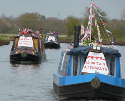
Two of WAT’s most important early actions didn’t directly involve practical restoration at all. Firstly, the Trust commissioned a feasibility study from WS Atkins which showed that restoration of the Arm was feasible; secondly, armed with this report, WAT was represented at a Public Inquiry into the A41 bypass, successfully putting forward the case for the road scheme to be modified to provide a navigable bridge. The Inspector ruled in their favour, and the highways authority took responsibility for creating a small diversion of the canal to enable the road to cross it less intrusively. All this behind-the-scenes work cost money, but the Trust had by now established the successful annual festival which generated funding and publicity for the restoration for many years.
Come the mid-1990s and the launch of the National Lottery, a bid to restore the entire Arm with cash from the Millennium Lottery Fund was unfortunately unable to source the necessary ‘matching funding’ of 50 percent of the estimated £8m cost from other funds. Realising that they were in it for the long haul, WAT broke the restoration down into three more manageable phases, and began Phase One: rebuilding the demolished Little Tring Bridge and reinstating the first 200 yards of the infilled length.
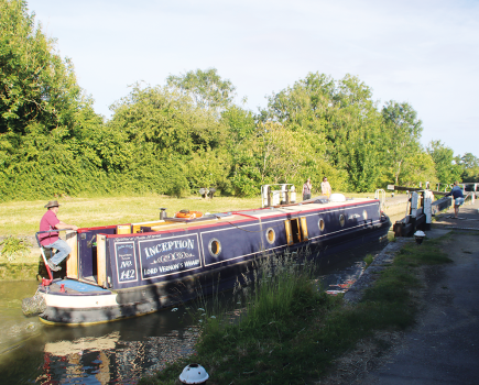
Although short, this section was very important: as an extension of the navigable network it would be a statement of intent; it would also be a testbed for WAT’s proposed method of rebuilding the dry length of canal which would need to defeat the leakage problem once and for all; and it would incorporate a widening which would form a winding hole (turning point) for full-length boats (up to then, those in craft more than around 40ft long could only cruise the one-and-a-half mile navigable section if they didn’t mind reversing back out again, which deterred most visitors).

Backed by a generous legacy to the Trust, the bridge was rebuilt by contractors as a traditional brick arch (but with hidden concrete strengthening) at a cost of around £235,000. Meanwhile, WAT’s volunteer team tackled the channel rebuilding with a long series of working parties. Much of the work was concentrated on rebuilding the channel walls, with a ‘production line’ system: removing the wooden shuttering from one completed length of concrete wall; pouring the concrete for a second length; erecting the shuttering for a third – repeat 70 times! This was combined with a flexible but waterproof bentonite matting material for the base, and the result was a waterproof channel for the first time in the Wendover Arm’s 200-year life. A ceremony in 2005 saw well-known actor and WAT Patron David Suchet declare the Phase One length open.
Having tested the method on Phase One, it was time to apply it to Phase Two, the remainder of the mile and a half of dry channel as far as Drayton Beauchamp. But first, two former bridges needed to be replaced, to provide footpath access across the canal and to enable walkers to be kept safe from the ongoing rebuilding work. Faced with a steep bill for having them professionally built, WAT’s volunteers built the two wooden footbridges, Bridges 4 and 4A, themselves.
Then it was time for the long slog of rebuilding the channel. Basically this consisted of the same method as had been used for Phase One, only for five times the distance. But there were a couple of added complications. Firstly, the need to use the canal bed for machinery access to the worksite: work started at the far end at Buckland Wharf, working slowly back towards Tringford, with the dumpers, excavators and other machinery driven along the bed to the worksite from the Trust’s materials store and site access area on the infilled length at Tringford.

And the second and more serious complication was the clay pipe which had been laid in a trench in the canal bed in 1911. It couldn’t be removed, because it was still carrying vital water supplies and would continue to do so until the restoration of the dry section of the Arm was complete and could resume its water supply function. (In fact, the section of pipe nearest to Tringford has now become sufficiently leaky that CRT no longer uses it, and the water is instead diverted into an underground channel from the old Whitehouses pumping station to Wilstone Reservoir and then pumped back up from there to Tringford.) So the channel had to be rebuilt in a way that wouldn’t put stress on the pipe, risking damage to the pipe or the channel above it.
This was achieved by excavating the channel bed to uncover each section of pipe (and its construction as a series of straight sections interspersed with sharp turns at the access manholes meant it wandered from side to side of the gently curving canal), then covering it in a protective layer of concrete, before rebuilding the channel sides and base in a combination of bentonite matting, concrete blocks to protect the matting, and soil to cover the blocks. One more complication: the narrow sloping sided channel meant mooring wouldn’t be possible for much of the way, so vertical-sided concrete mooring bays were built at intervals.
On the plus side, one section that the volunteers wouldn’t need to rebuild was at the Drayton Beauchamp end of this length, where the canal diversion works for the A41 Aston Clinton Bypass (opened in 2003) had taken care of a quarter-mile length of channel. And as regards financing the work, for once the Arm’s role in supplying the Grand Union with water worked in their favour. An acceptance by the then British Waterways (CRT’s predecessor) that without WAT’s restoration work it would have had to spend £200,000 on dealing with problems with the pipe and clearing vegetation from the channel in order to maintain its water feed saw BW hand over this sum towards the work.

All in all, considering that it took several years to rebuild the first short Phase One section at Tringford, it’s not surprising that 15 years on, the volunteers are (or would be, Covid permitting) still hard at work on the Phase Two length. They have now reached the point where the canal has been rewatered back to Bridge 4a, this year will see the latest rebuilt length from there to Bridge 4 rewatered, and the team are now within half a mile of the navigable limit at Tringford. But there’s another fly in the ointment…
While this work was in progress, a bid was submitted to the Heritage Lottery Fund for a grant to complete the Phase Two work,
including both the channel lining and also the re-excavating of the 200 yards at Tringford (just beyond the current limit of navigation) which had been infilled. And the good news in 2016 was that the initial bid had passed the first stage of the approval process. Unfortunately, further investigation of the infilled length showed that what had been believed to be harmless fill was actually classed ‘toxic waste’ – it was typical early 20th century domestic rubbish, largely ashes, which contained traces of lead (common in paints and plumbing in those days). It could be dealt with by taking it to a processing plant where mixing it with other spoil would dilute the contaminants to acceptable levels, but the cost of this would put it well beyond the total allowed for in the funding bid, which left WAT with no option but to withdraw the bid.

With the work now not too far from Tringford, WAT has been considering this issue, and recently paid for a successful trial excavation of a section of infill. The upshot is that the Trust’s funds can now support the removal for processing of the entire 200 yards of infill – but that will leave it in a position of having to raise significant cash for plant and materials in order to keep the volunteers at work completing the final half mile of channel rebuilding.
If that can be achieved (and WAT is exploring various possible sources of funding), the canal can open to Drayton. And with the remaining length (‘Phase Three’) from there to Wendover already in water, it might seem to be plain sailing from then on. But it’s not quite that simple. Firstly, the water in Phase Three section is about a foot below original level: raising it wouldn’t just show up the odd leak; there are places near the Wendover end where erosion of the towpath over the years has meant that it couldn’t be raised without flooding over. And secondly, there are three bridges built since the canal closed which don’t provide navigable headroom – the old A41 and a minor road in Aston Clinton, plus another minor road in Halton.

The first of these issues is already being partly dealt with, thanks to a local authority funded programme of works in Wendover. This is aimed at improving the towpath for walkers, but has the added benefit of enabling the water level to be raised in the future. Dealing with the second problem of the road bridges will be more expensive; but, in the meantime, simply getting the canal open to Drayton must help to make the case for removing the remaining blockages in the way of getting boats back to Wendover.
And on that subject, WAT is understandably wary about quoting any reopening dates for the whole canal; but in the medium term if the funding can be found to keep the volunteer team busy, a 2025 opening to Drayton Beauchamp seems feasible.
You can help them to achieve their aim: the Wendover Arm Trust welcomes new members, supporters volunteers and donations

Image(s) provided by:
Martin Ludgate