The coal traffic which sustained Yorkshire’s busiest freight waterway for three centuries may have vanished, but the Aire & Calder is still impressive to cruise – and may yet have a cargo-carrying future

Some years ago I remember an article about the Aire & Calder Navigation titled King Coal Canal. While out taking the photographs for this cruise guide, I couldn’t help but reflect that unless you were writing a history feature, you wouldn’t use that title today.
In the last couple of decades the tugs with their trains of three coal ‘pans’ heading for Ferrybridge with 500 tons of Kellingley Colliery’s finest have disappeared; as did the pairs of coal barges coming down the Wakefield line before them; and the trains of 19 small ‘Tom Pudding’ container boats heading for the hoists at Goole have long since gone. And that’s just the coal trade: more recently its disappearance has been followed by a decline in other cargoes – such as gravel and oil – so that from being a busy commercial waterway as late as the 1990s, the Aire & Calder is now almost entirely the preserve of pleasure craft.
But note that I said ‘almost entirely’: steel traffic from Goole still uses the easternmost length on its way to Rotherham via the New Junction Canal, and just recently, a new regular trade has begun between Goole and Lemonroyd Lock. It’s only a couple of trips a week to begin with, but there are hopes that it will build up in time. And although the sight of several hundred tons of cargo heading your way might make some visiting narrowboaters nervous, somehow these wide channels with their large mechanised locks cutting purposefully through the mainly flat landscapes between Leeds and Goole just don’t look the same without some of the heavy trade that they were built (and repeatedly rebuilt and enlarged) for.
There’s still plenty of waterborne freight to be seen at Goole, where we start our journey at the eastern end of the Aire & Calder Navigation’s main line, but these days it’s mainly seagoing trade entering and leaving Goole Docks via the ship locks connecting to the tidal Yorkshire Ouse. Most visiting inland boaters will arrive and leave via one of the Aire & Calder’s four other connections, but Goole is the main access for full-length narrowboats whose only route to Yorkshire’s waterways is via the River Trent to Trent Falls and then the Yorkshire Ouse.

Must see: the Yorkshire Waterways Museum at Goole features a selection of historic boats including the barge Sobriety and several survivors of the Aire & Calder’s trains of compartment boats known as ‘Tom Puddings’. There are indoor displays of local waterways, and boat tours to see the docks and a preserved Tom Pudding hoist.
Once clear of the dock area (and those who aren’t travelling through to or from the Ouse should avoid it completely), there are visitor moorings at the beginning of the canal, where you can moor up to visit the town and the Yorkshire Waterways Museum (see panel) before heading west along the navigation.

You may have noticed that I’ve used the words ‘navigation’ and ‘canal’ interchangeably up to now: that isn’t just sloppiness on my part, it’s actually both. Opened as early as 1704 as a river navigation based on the Aire and Calder rivers, the waterway was continuously enlarged and improved throughout its commercial life – and the largest single improvement was the bypassing of many miles of winding River Aire in 1826 by the opening of the 19-mile Knottingley and Goole Canal. It is this canal which we are following out of Goole, as it heads westwards accompanied on its south side by the Dutch River (an artificial channel which now forms the tidal outfall of the River Don).
See also: Middleton Railway, a 20-minute walk from Knostrop or a bus ride from Leeds, this former horse-drawn colliery line pre-dates the railway age as the world’s oldest working line. Industrial steam engines now haul passenger trains.

Straight and with few bridges, it isn’t the most exciting of wateways, but it’s where you’re most likely to encounter working barges. Passing Rawcliffe, a dog-leg to the left brings the canal to a junction where the New Junction Canal diverges southwards. This was built jointly by the two companies to link the A&C to the Sheffield & South Yorkshire Navigation, and opened as late as 1905. Dead straight from end to end, you might think it even less exciting than the first length of the Aire & Calder, but its five miles are enlivened substantial steel aqueducts over the rivers Don and Went, plus a series of liftbridges and swingbridges and one lock, all power-operated by boaters.
The main line continues its westerly course. Passing Pollington, Great Heck and Eggborough villages (all with useful pubs) and climbing through Pollington and Whitley locks. These, like most on the Aire & Calder system, are large chambers around 200ft by 20ft, and although equipped for keeper-operation are generally unmanned these days and worked by boaters using a Canal & River Trust key.
The canal has been crossing fertile farming countryside so far, but approaching Knottingley there are increasing signs of industry. The remaining traces of the cargo that sustained the waterway for so long are disappearing, though: Kellingley, the last deep coal mine in the country and the source of much of the canal’s trade 20 years ago, finally closed in 2015.
Knottingley is a handy place to stop for shops, and it’s also where the long canal section ends and the waterway finally makes the acquaintance of one of the rivers in its name. But before we continue west through the town, we’ll take a sharp right turn onto what was originally part of the main route of the navigation, but now forms a branch leading to Selby. Soon comes Bank Dole Lock, looking rather forlorn with its lock cottage’s windows bricked up. Unlike the locks we’ve seen so far, it’s manually operated, its dimensions are more familiar to narrowboaters (albeit it will take a pair of full-length boats with room to spare), and it opens onto a length of the River Aire heading downstream.

This was the route that boats heading down from Leeds towards Goole would have travelled in the early days before the Knottingley & Goole Canal was built. With its twisting natural course interrupted by just the odd modestly sizes lock and adjacent weir at Beal, it perhaps gives more of an idea of what the original Aire & Calder Navigation looked like. Beyond West Haddlesey, the original route continued via a long-abandoned lock leading onto the tidal Aire; today’s navigation bears left through a flood-lock onto the Selby Canal.
Five miles long, this was opened under an earlier improvement scheme in 1778, which bypassed the tidal reaches of the Aire and formed the main route to the Ouse until the 1826 improvements. Today it forms a handy link for those heading up the Ouse to York and the Ripon Canal or simply visiting the attractive market town of Selby, as well as being a pleasant cruise in its own right.
Back at Knottingley, the main line continues through the rather industrial town, brightened up by ‘Freda’s Garden’ – a length of towpath which a local resident used to plant with wildflowers and garden plants, and where a volunteer group now continues this in her memory.
Ferrybridge is another useful stopping point for shops and pubs, and was another name closely associated with the coal trade, as its power stations were the destination of much of the cargo. But now the last of the three power stations has closed, and the cooling towers won’t loom over the waterway for much longer. The lock is rather an oddity – not quite straight, and with sections of the chamber walls built from stone, brick, concrete, steel piles, and timber. It finally leads out into the River Aire, which forms the main line of the navigation for the next four miles, as it meanders through former industrial land that is gradually being reclaimed and landscaped. This length lacks a towpath, but walkers can detour to the north via a series of footpaths.

Bullholme Lock marks the approach to Castleford, whose town centre can be reached on foot via a striking modern bridge over the weirstream – which also affords a fine view of the remains of an unfortunate barge which went over the weir some 40 years ago. The lock cut ends with an odd-shaped flood lock which may or may not be in use depending on river levels, leading to a waterway ‘crossroads’.
Don’t turn left – unless you want to emulate the unfortunate barge mentioned above – but instead turn right to continue up the River Aire towards Leeds, or straight ahead for its tributary the Calder, on which the Wakefield branch of the navigation is based.
As with the main line, the Wakefield line has seen many changes, and uses far less of the river for its route today, but the first couple of miles follow an attractive reach of the Calder leading to Whitwood. Fairies Hill Lock leads off on the left: formerly the navigation route, this was bypassed by the present line but has been partly reinstated as private moorings. The towpath still follows the old route, where you can find traces of another long-abandoned lock; meanwhile the navigation passes through the single very deep Woodnook Lock.
Stanley Ferry has some interesting waterway claims to fame. Firstly, it’s a rare example of a river navigation crossing its own river on an aqueduct – or rather, since 1981, an even rarer example of one crossing on a pair of aqueducts. The original fine cast iron structure with its trough suspended from metal arches alongside (on a similar principle to the Sydney Harbour Bridge), which dated from an improvement scheme of the 1830s, was suffering from distortion. With heavy loaded barges still using the route it was felt safest to replace it with a modern concrete aqueduct, but to renovate the original and retain it for pleasure boats. Stanley Ferry’s second claim to fame is that it’s the location of one of CRT’s two remaining lock gate building workshops. And finally, Stanley Ferry was the site of a very unusual freight operation, whereby ‘Tom Pudding’ compartment boats were winched out of the canal, put on railway trolleys, and taken by rail to a nearby pit for loading.

A final flood lock leads back into the Calder for the last mile to the edge of Wakefield, where the through route is continued by the Calder & Hebble Navigation, leading in turn to the Rochdale and Huddersfield trans-Pennine canals.
See also: Thwaite Mills, a water-powered mill which produced dyes, oils and putty right up to 1976 is now a working museum. See Thwaite House, the Georgian mill-owner’s home, the workers’ cottages, and the mill engineers’ workshop.

Back at Castleford, the main line of the navigation follows the River Aire along what is today a very attractive length of river flowing between heavily wooded banks – but which not that many years ago was a bleak area of opencast mining, and the site of a major breach when the river’s water flooded into the coal workings. The navigation was eventually rebuilt on a new alignment, and two locks were replaced by one new one – hence the great depth of Lemonroyd Lock.
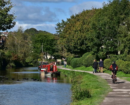
Just above is the depot that’s the destination of the new barge traffic, so the last few miles into Leeds are the preserve of pleasure boaters now. Woodlesford has moorings, shops and pubs, separated by a final couple of miles of countryside from the industrial approaches to the city.
Thwaite Mills are followed by Knostrop lock and the flood lock at the top of the lock cut. These are the last of the large mechanised locks, with Leeds Lock being something of a ‘halfway house’. It’s a conventional-looking lock taking craft up to about 68ft long, which has been mechanised and extended by the addition of extra gates for longer boats – but these are manually operated and currently out of use pending repairs.
That’s a shame for owners of 70-footers, as even though there’s only another three quarters of a mile until the first of the Leeds & Liverpool Canal’s 62ft locks, it’s a fascinating length of urban navigation. In recent years it’s become the centrepiece of a lively regenerated area of the city centre, and it’s a great finale to our journey along a waterway which has seen so many changes in its long life.

10 waterside pubs
1. Macintosh, Aire Street, Goole. 01405 763850
East from visitor moorings, left into Lower Bridge St, right into Stanhope St, bear right at roundabout and first right. Recently reopened pub near the docks with real ale, cider and garden

2. King’s Head, Main Street, Pollington. 01405 861507
10 mins north east from Pollington Bridge and right into High Street. Cosy village local with local real ale, food and garden

3. Bay Horse, Main Street, Great Heck. 01977 661121
5 mins north east from Heck Bridge. Traditional country pub with open fire, local Old Mill real ales, food and outdoor seating
4. Horse & Jockey, Weeland Road, Eggborough. 01977 661295
10 mins north from Whitley Bridge. Large, popular pub in village centre with real ale, food and outdoor seating
5. King’s Arms, Beal. 01977 607180
By Beal Bridge. Modern village pub and restaurant with real ale and garden
6. Steampacket Inn, Knottingley. 01977 672093
By Cow Lane Bridge. Lively locals’ town pub with CAMRA award winning real ales, food, garden, children’s play area and moorings
7. Golden Lion, Ferrybridge. 01977 674028
Waterside above the lock. Former coaching inn on Great North Road with oak panelled rooms, real ale, food and garden
8. Griffin Inn, Castleford
By Barnsdale Road Bridge. Small, popular traditional local, recently refurbished under new management with real ale, lunchtime food and garden
9. Stanley Ferry. 01924 290596
By aqueduct. Large family-friendly Hungry Horse chain pub, real ale, food, garden
10. Midland Hotel, Aberford Road, Woodlesford. 0113 282 2357
10 mins south west from Swillington Bridge. Friendly local, real ale, food, garden, acoustic music nights Thursday
Pub details are likely to change at short notice: you are advised to phone ahead to be sure
Image(s) provided by:
Martin Ludgate