Follow the River Kennet through rural Berkshire and the centre of Reading, to reach the Thames

The village of Theale lies some six miles west of Reading on the River Kennet Navigation, and conveniently for a one-way walk, the two are also linked by a railway line. We’re starting at Theale and heading east – partly because for those arriving by road, it’s easier to park there.
But there’s no reason why you can’t do the walk in the opposite direction; especially if you fancy ending with something to drink – Theale used to have so many pubs that it was suggested the name was derived from ‘the ale’, and several of them are still in business.
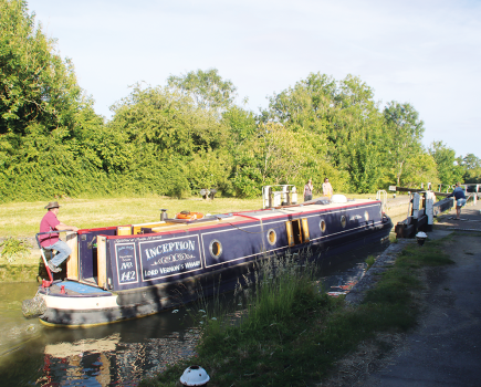
Theale and its hostelries are to the north from the railway station, but our walk begins by heading south, to meet the navigation at a swingbridge. Turn left onto the towpath, and just around the bend is Sheffield Lock.

Although mainly of interest to boaters, walkers will also find the locks along this stretch worth pausing to look at, if only for the variety of shapes and sizes. This one’s rather larger than most, dating from when large Thames sailing barges used the waterway, and has curious scalloped edges. And half a mile further on, you’ll pass Garston Lock, a rare surviving turf-sided structure. Disappearing into the undergrowth on either side are two World War II concrete pill-boxes, recalling the days when the Kennet was seen as a possible line of defence in the event of invasion.
It’s hard to imagine this quiet waterway being the site of fierce fighting, but the peace is disturbed a little by the M4 motorway as our walk continues between watermeadows and lakes (formed from old gravel quarries) towards Burghfield. By contrast to the canal-like first mile, we’re now on what’s clearly a natural river, with some tight bends to challenge the boat steerer, if not the walker. Our walking surface has also changed, from a ‘proper’ towpath to a rough footpath running through riverside meadows – so boots are a good idea in winter.
Burghfield Lock (a modern steel-piled chamber with some remains of the old turf-sided lock visible beyond) is followed by Burghfield Bridge, with a handy waterside pub and a handful of buildings, before the navigation returns to the countryside accompanied by more flooded gravel pits. We’re now only three miles from the centre of Reading, but the tendency of the river to flood has helped keep urban development at bay.

We begin to see more signs of the town’s approach at Fobney Lock (another big Thames barge-sized one), which is accompanied by Reading’s main waterworks on one side, its sewage works and recycling station on the other, and followed by a bridge carrying main road the A33 into the town from the south, accompanied by retail and business parks. But for all that, the narrowing river and the towpath (which crosses the tail bridge at Fobney Lock and then ducks behind a pumping station building) manage to retain a semi-rural appearance thanks to trees lining the route on both sides.
Turning to head northwards, our walk finally enters urban Reading properly, with a long line of Victorian town houses backing onto it from our right, many of the gardens terraced steeply down to the water, several with boats moored.
Bear Free Wharf moorings are sandwiched between two main road bridges, the second of which (A329) also doubles up as a towpath crossing, (the footbridge which used to run across County Weir to County Lock having disappeared). But this needn’t matter to us, as walkers can continue on the left-hand side of the river.

An unusual set of boat traffic lights guards the entrance to what was once a narrow, twisting and fast-flowing length with no towpath known as Brewery Gut.Not any more: this area has been reborn as the Oracle shopping centre, and that’s another reason for walking the route in this direction at this time of year – you might just want to check out the January sales near the end of your walk.
You’ll need to cross one of the three footbridges in the Oracle Centre to end up on the right-hand side of the river, which passes under the old, stone-built and not very aptly-named High Bridge to reach an area known as Kennet Side.
From High Bridge, it’s only a few minutes’ walk to Reading Station – but if you have time, carry on a little way yet.

Kennet Side is a pleasant urban waterside walkway which passes two riverside pubs and Blake’s Lock, the last on the River Kennet and operated as part of the Thames by the Environment Agency. (Not that it affects walkers, but if you’re familiar with the manual locks above Oxford, you’ll see similarities.) There’s also the small Riverside Museum to visit: it’s the far side of the weir stream beside the lock, so to reach it, you’ll need to either cross the footbridge below the lock or the last road bridge above it.
Passing the second of the pubs, the Kennet comes to a rather ignominious end amid railway bridges and a gasometer as it joins the Thames. Cross the footbridge which is attached to the last of the railway bridges, and follow the Thames up-river. A wooded length masks a riverside supermarket and new housing, then the path cuts across King’s Meadow to reach Caversham Lock.
Not far beyond is Reading Bridge: carry on under it, then after about 100 yards turn left to leave the riverside via a footpath / cycleway. This leads to a main road: just to your right is a pedestrian crossing. Cross this and straight ahead of you is the north entrance to the railway station, with a regular half-hourly train service back to Theale.
Image(s) provided by:
Martin Ludgate


