We explore two contrasting river navigations, heading out from the heart of East London into the Essex and Hertfordshire countryside, to help guide you on your next canal boat excursion…

Fancy stopping for a pint? Check out our top ten pubs on the Lee and Stort Navigations here
THE RIVER LEE
Strictly speaking, perhaps a guide to the Lee and Stort navigations ought to begin from the Thames east of Blackwall in East London, where Bow Creek, meets the Thames – on the grounds that this is historically and geographically the ultimate end of the River Lee (Bow Creek being the name given to the final tidal windings of the natural river). But out of the three ways of arriving on the Lee by water, the Bow Creek route is the one that inland boaters are least likely to use, being of most use to those arriving from the Thames estuary.
Canal Boat readers are much more likely to reach the Lee via one of two other waterways which provide handy links from the Regent’s Canal and the rest of the inland waterways network.

On East London’s Limehouse Cut, one of three ways of reaching the River Lee
One of those two other routes is the Limehouse Cut, a short and mainly straight waterway but with a long and complicated history. Opened in 1770, it provided a direct link from Bow on the Lee to Limehouse on the Thames, it knocked some seven or eight miles off the journey from the Lee to the City of London. Today it’s accessed from Limehouse Basin, the former dock which forms the eastern terminus of the Regent’s Canal and its link to the Thames. But until the 1960s the Cut had its own separate entrance from the Thames, and you can still see the filled-in remains of the old entrance lock if you walk a few yards east along the street that crosses the Limehouse Basin entrance lock.
The direct connection from Limehouse Basin makes the Limehouse Cut a handy route to the Lee both for boaters who have arrived down the Thames through central London, and those who have come via the Regent’s Canal, although for the latter there is a slightly more convenient route, as we shall see later.
Leaving Limehouse Basin via a sharp bend and cruising up the Limehouse Cut, you can spot a remnant of the Cut’s more recent history in the form of a vertical concrete channel which once supported a ‘guillotine’ style flood barrier, which (in tandem with a similar structure on Bow Creek) could be lowered to keep tidal floods out. It was superseded by the Woolwich Barrier in the 1980s. In earlier days there was once a lock here.
The Limehouse Cut used to be a bleak waterway hemmed in by anonymous industrial blocks and seldom navigated (I think I saw one boat on it in the ten years that I lived nearby), but today there are residential developments on its banks, pontoon moorings have been created, and a small mooring basin on the right. A floating pontoon towpath (created a few years ago to fill a ‘missing link’ in a traffic-free route from Central London to Hertfordshire) takes the path under the Blackwall Tunnel approach road, and behind it you can spot a surviving lock gate from another old lock abolished many years ago.

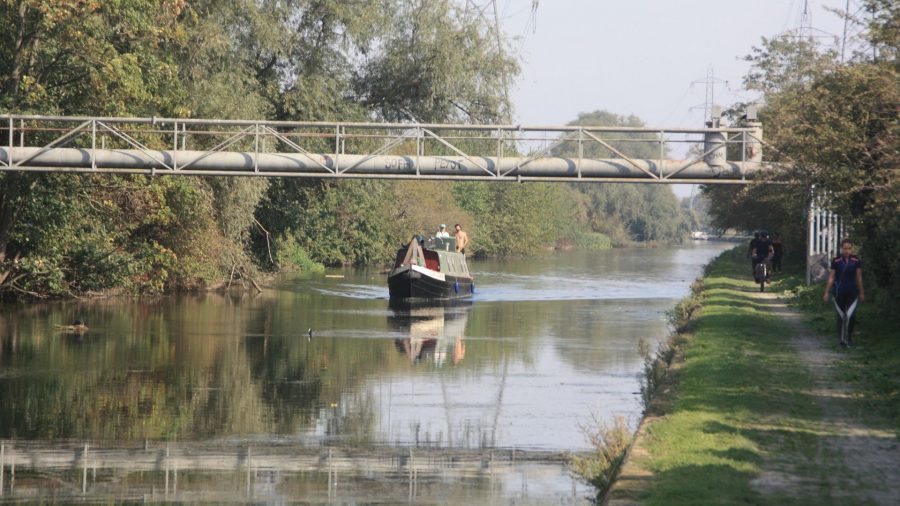
Old Ford Locks are mechanised and operated by boaters using a Canal & River Trust key, like most locks on the lower reaches of the Lee
The Bow Creek route joins us from the right and we enter the Lee Navigation ‘proper’ at Bow Locks, another site which has seen a few changes – the most recent and significant for boaters being that in 2000 the locks were reduced from a pair to a single lock, which was fitted with an outer flood gate to keep high tides out. Until then, the Limehouse Cut and the next mile of Lee Navigation up to Old Ford had been semi-tidal, so for a few hours around high water its level rose by up to three or four feet – which not only made for a tight squeeze under low bridges and sometimes flooded the towpath, but led to an accumulation of silt.
Passing the House Mill and the Clock Mill, the surviving two of the Three Mills that gave their name to this area, the Lee Navigation heads north, St Thomas’ Creek diverging on the right to provide one link to the Bow Back Rivers, a local network of navigable millstreams and formerly tidal creeks. New developments, surviving industry, and the fringes of the 2012 Olympic Park characterise this length leading to Old Ford Locks (where the Old River Lee branches off, providing another connection to the Bow Back Rivers).
Old Ford, like most locks on the lower reaches of the river, are paired and mechanised (dating from the river’s days as a commercial freight carrier which lasted into the 1980s), these days operated by boaters using a Canal & River Trust ‘Watermate’ key. Above is another stretch which I remember being rather forlorn and unused (an angler once hailed me while I was steering a boat south through here to tell me I’d “gone the wrong way” – it turned out he’d been fishing there for several years and never seen a boat go that way before!)
Entering on the left, shortly, is what the friendly angler had assumed I’d accidentally missed – the entrance to the Hertford Union Canal, whose one-mile straight route with three locks runs alongside Victoria Park, and provides a short-cut from the Regent’s Canal to the Lee. And meanwhile on the Lee there’s no shortage of boats today – indeed it’s no secret that moorings can be somewhat hard to find at times, especially in popular areas near transport or facilities – while the surroundings have gone from forlorn to trendy.
We’re now on a length originally built as the Hackney Cut, one of numerous straightenings and bypasses built during the many improvements in the long history of the Lee Navigation – the story of the river goes back so far that it’s the subject of the oldest still extant Act of Parliament relating to an inland waterway; the Act is written in Norman French.
While on that subject, I’ll briefly mention the spelling of the river’s name. Both ‘Lea’ and ‘Lee’ are acceptable for the river (and historically ‘Ley’ was also used, and has survived in the names ‘Leyton’ and ‘Leytonstone’), but for the navigation the Acts of Parliament and other official documents since the 18th century have used ‘Lee’, so I’ve used that throughout.
The natural river channel is some distance to the east of the Navigation, separated from it by Hackney Marshes which are heavily used by local sports teams – at one time there were 120 football pitches; these days there are fewer but cricket and rugby are also played. The river channel rejoins beyond Pond Lane Bridge – but there’s still a flood relief channel taking much of the river’s flow, so the waterway isn’t greatly affected by currents.
Locks continue at intervals, mostly paired and mechanised – look out for ‘Alfie’s Lock’, officially known as Pickett’s Lock but renamed in honour of retired lock keeper and local legend Alfie Saggs. Meanwhile there are reminders of the river’s freight-carrying days, including former timber loading cranes (imported wood was an important cargo, along with grain and metals) and mechanised capstans at several locks which were used for manoevring unpowered lighters.
On the east side, the high banks of a series of reservoirs accompany the navigation on the long straight reaches which lead out through North London’s suburbs; on the west side there’s a fair amount of industry, and power lines follow the navigation to complete the scene. But it isn’t all bleak and industrial: Walthamstow Marshes are now a nature reserve, while near Picketts Lock the Lee Valley Leisure Centre provides a range of sporting and water based activities.

Cruising on the River Lee near Enfield
At Enfield Lock (apart from the bottom gates it’s manually operated, as are all the locks from here on) the reservoirs and industrial estates are left behind, and the navigation begins to run through something akin to countryside – although this area was once home to an important industry: the manufacture of explosives. The former Royal Gunpowder Mills at Waltham Abbey (complete with the remains of their own canal system) now form a fascinating museum.

By Waltham Abbey the last of the built up area has finally been left behind
Passing between Waltham Cross and Waltham Abbey, the Lee finally shakes off the last of London’s trappings and passes through an area of lakes formed from old gravel pits as it continues its straight course northwards past Cheshunt. Then at Broxbourne the long straight lengths are finally at an end, and the waterway takes a much more river-like meandering route past Carthagena Lock (named, it appears, after a battle in the War of Jenkin’s Ear), Dobb’s Weir Lock and Feilde’s Weir Lock to reach a junction. This is where the River Stort Navigation bears off on the right at the start of its 14 mile route to Bishop’s Stortford (see page 50) – but to the right of the entrance to the Stort you’ll also see a weir structure, which carries water into the Flood Relief Channel. This means that from here onwards, for the first time since the start of our journey in East London, we’re finally travelling along a single channel carrying the entire flow of the River Lee. Not that it’s a particularly fierce river, although as with all river navigations it’s subject to changes in current and level after heavy rain and should be treated with appropriate respect.

Passing Feilde’s Weir, where the River Stort branches off
So it’s a rather impressively wide waterway that turns westward and winds its way gently to Rye House (scene of a famous conspiracy – you can visit the historic Rye House Gatehouse nearby and find out about it) and onwards towards Hertford. Stanstead Abbots and St Margaret’s are a pair of ‘twin villages’ – one each side of the river – accompanied by a handy boatyard. Watch out for a couple of idiosyncrasies at Stanstead Lock: firstly there’s a swingbridge across the chamber, which will need to be opened before you start filling the lock (except for very short craft); secondly it’s fitted with ground paddles only at the top end, which can be quite fierce (it’s a deepish lock) so open them cautiously.

Stanstead Lock: unless your boat’s a small one like this one, you’ll need to open the swingbridge
The pleasant, rural course continues westwards to reach the handy town of Ware, notable for its curious waterside gazebos – 18th century brick and timber summerhouses by the water’s edge – and also for having a lock that’s maintained and run by the Environment Agency, rather than the Canal & River Trust. This curious situation arose because of the function of lock (and associated weir) in controlling the level of water in the reach above, which feeds water to the New River, a drinking water supply channel opened in 1613 and reaching all the way to Islington in North London (today you can walk alongside it for much of the route). The lock keepers were therefore employed by the New River Company, and in due course the jurisdiction passed to the Metropolitan Water Board, Thames Water Authority, National Rivers Authority and ultimately the EA. But don’t worry – for the purposes of boat licensing it’s still regarded as a CRT waterway.
The final length of the river is characterised by waterside meadows before a straight artificial cut heads off south westwards to Hertford Lock, the final lock on the river, and into the industrial outskirts of the town. Factories give way to housing as the waterway nears the town centre, with visitor moorings to explore the attractive old market town and a popular waterside pub on the right. A triangular pool where the river rejoins the navigation marks the turning point for full-length boats, while smaller craft can continue a few yards further to the town bridge.
We will now return to Feilde’s Weir to explore the River Lee’s tributary the Stort, a very different river…

Moorings by the Old Barge pub, not far from the limit of navigation in Hertford
THE RIVER STORT
The Lee and Stort are spoken of in one breath, but they’re contrasting rivers in many ways. While the River Lee spends much of its lower reaches escaping London’s clutches, the Stort is almost entirely rural. The long, straight, broad, largely artificial southern lengths of the Lee Navigation with duplicated powered locks still have something of the atmosphere of a commercial waterway (even if the last regular barge trade ended decades ago), while as soon as you leave Feilde’s Weir junction at the beginning of the Stort, you’ll realise straight away that what you’re cruising is largely the narrow, winding, unaltered route of a natural river.
That’s not to say that it didn’t have its commercial history, as we shall see. But as it winds its way north eastwards, climbing through the first two locks, the Stort has the feel of a rural byway, with few main roads passing nearby – and just a railway line for company.
Oh, and on the subject of the locks: their size is another change from the Lee – they’re slightly narrower at 13ft 6in, and yes, that means they’re just too tight for two narrowboats to share (although that hasn’t stopped people trying, sometimes with unfortunate results).

On the winding lower length of the Stort below Roydon
Passing Roydon Marina (accessed via a new lock built a few years back) the canal takes a right turn to merge with a mill stream and arrives at Roydon village. (Incidentally when you’re coming back downstream, remember to look out for the left turn, or you’ll end up at a dead end in the old mill pool.) The river winds past the attractive village before heading out into Hunsdon Mead, a watermeadow and nature reserve notable for its fine display of flowering plants in spring and early summer.

Moorings at Roydon Mill. The navigation passes through the bridge just visible on the left
Hunsdon Mill and Parndon Mill locks continue the gentle climb, as the river begins to skirt around Harlow. Despite the proximity of the New Town (the railway station is right by Burnt Mill Lock), with its tree-lined route the river manages to keep its distance and retain its rural feel. Another winding length leads to the attractive old town of Sawbridgeworth, where some fine old maltings buildings (and modern housing copying their style) remind us that barley malt for London’s breweries was once a major trade on the Stort – and a reason for making it navigable in the 1760s.

A quiet stretch of the Stort near Hunsden
Leaving Sawbridgeworth behind, the river enters one of its most winding lengths as it passes Tednambury and Gaston Green – take care on the bends, especially in longer craft – to reach Spellbrook Lock. Two further locks bring us to the start of the approach to Bishop’s Stortford, the former maltings town (it is said that the smell of malt pervaded the town up to the 1960s) which forms the terminus of the navigation. An eye-catching modern footbridge, spanning the river at an oblique angle, signals our arrival in the town. Sadly the original terminal basins were infilled in the 1970s but the navigation ends with a small arm where boats can turn, with handy moorings to visit this lively market tow.

Wooded length of the Stort below Harlow Mill

Old riverside maltings in Sawbridgeworth
Image(s) provided by:
Martin Ludgate


