No more than 20 miles long altogether, the Caldon and its arm to Leek manage to pack in as much interest as many much longer waterways – and some stunning Staffordshire scenery too

I’ve always felt that the Caldon Canal represents a microcosm of the the whole English canal system. It’s got aqueducts, tunnels, arms, odd locks, staircase locks, flights of locks, junctions, basins, the lot. Add in some particularly splendid scenery in the Churnet valley, a good helping of fascinating industrial remains, and a bunch of optimistic canal restorers aiming to extend it in two different directions – and it really is the canal that has very nearly everything. And it manages to squeeze it all into no more than 20 miles.
Having said that, descriptions of the Caldon used to backtrack a little on the attractiveness by describing the industrial grime surrounding its beginnings at the heart of the Staffordshire Potteries connurbation, with “little sign of the splendours to come”, or some such expression. But in recent decades even that first length, where it leaves the Trent & Mersey Canal’s summit level at the top of Etruria Locks and not far from Stoke-on-Trent Station, has been transformed. A statue of the great canal engineer James Brindley overlooks what are now park-like surroundings of the canal’s first length, while the Etruscan Bone and Flint Mill (which prepared two important additives used in pottery) is now a working industrial museum.
Speaking of James Brindley, his association with the Caldon wasn’t a terribly happy one. In 1772, while the Trent & Mersey was still under construction (the great tunnel at Harecastle and the tricky northern section took rather longer than expected), he was carrying out some initial survey work for a possible branch heading eastwards to Leek and Froghall, when he was caught out in the rain and drenched. He caught a chill, made matters worse by remaining in his wet clothes and sleeping in a damp bed at an inn, became seriously ill and died on 27 September. (Incidentally the writer got comprehensively drenched while taking the photographs for this article; let us hope Brindley didn’t set a precedent.)
It was therefore Brindley’s successor (and brother-in-law) Hugh Henshall who went on to do the detailed work on this branch, which became the Caldon Canal as we know it. Its 17-mile route opened in 1777 from Etruria to Froghall, where it was connected to the limestone quarries at Cauldon Low (the spelling varies somewhat) by the first of a succession of horse tramways.

To reach Froghall the canal needed first to climb the valley of the upper Trent (no more than a small stream by this point), and then descend the Churnet Valley – and the climb begins immediately with a pair of staircase locks. These lead to a surviving example of the sort of industrial surroundings which until not very long ago typified the first few miles of the canal, but are rapidly changing as new developments replace old industries. It’s not an unpleasant length, with old red brickwork disappearing behind encroaching vegetation.
A third lock, Planet Lock, leads to an unexpectedly leafy section leading through Hanley Park, before the mix of old industry and modern developments returns. A new housing development looks across the water to a surviving pair of characteristic Potteries bottle kilns as the Caldon, built using the typical early ‘contour canal’ method, twists left and right to follow the valley side.
Ivy House Lift Bridge is the first example of a characteristic Caldon feature, and carries a minor road across the canal. The urban surroundings begin to thin out, with playing fields and residential areas surrounding the waterway as it gradually begins to leave the Potteries behind.
The first genuinely rural lengths lead to Milton and then on to Norton Green, where a feeder enters the canal from Knypersley Reservoir, reminding us of the Caldon’s other main purpose besides serving the limestone quarries. It brings in vital water supplies for the Trent & Mersey’s main line – and this has left its mark on the Caldon, as we shall see.

A flight of five locks raises the canal through Stockton Brook village to its summit level, and a mile further on at Endon is a basin which is home to Stoke-on-Trent Boat Club. Look out for the odd circular island in the canal near the basin – not just to avoid hitting it, but because it’s an interesting piece of canal heritage. A railway siding serving a nearby mill once crossed here on a swingbridge, as recalled by a short preserved length of track and an interpretation board on the non-towpath side of the canal.
Another two miles of quiet countryside lead to Hazelhurst (or Hazlehurst) junction where the Leek Arm leaves the Froghall line – and to a historical quirk of the canal. Although geographically Leek is towards the left and Froghall to the right, it is the Leek arm which bears off right, while the Froghall line continues straight ahead. Why? It’s quite a complicated story…
As built in the 1770s, the Caldon summit was very short, and by Hazelhurst the canal was already descending towards Froghall. But by the 1790s, the Trent & Mersey was so busy that it needed extra water supplies, and the upper Churnet Valley at Rudyard, north of Leek, was identified as a location for a large new reservoir. The feeder to bring water down from the reservoir to the Caldon could be combined with a branch canal to serve Leek town – but the water supply function meant that it would need to meet the Froghall line somewhere on its summit level.
To make this easier, the old locks at the original east end of the summit were abandoned, and the summit level was extended eastwards on new route to make a junction with the new Leek Arm at Hazelhurst. A new set of three staircase locks then re-connected the canal to the original route to Froghall. Unfortunately this arrangement proved unsatisfactory as the staircase locks were a bottleneck and wasted water, so 50 years later part of the original line was reinstated, passing under the Leek Arm on a new aqueduct, and climbing by three new single locks to meet it at the present-day junction. Is that clear?

We’ll explore the Leek Arm first – but while we’re at this intriguing but attractive junction, I’ll mention another oddity. Back in the 1960s and early 1970s, the line to Leek was legally abandoned but navigable, while the one to Froghall was officially open but stanked off and unusable. And it’s largely down to that water supply function again.
In the 1940s the Trent & Mersey’s then owners the LMS Railway sought to divest themselves of a lot of canals carrying little or no traffic, and did so via the 1944 Act of Parliament. These included the Huddersfield, Llangollen, Montgomery, and the Caldon’s Leek Arm – but not the Froghall line as it was still in use. However the Arm was kept open for work-boats as it still retained its water supply function (apart from the final mile in Leek which was filled in).
On the other hand, by the early 1960s the Froghall line had lost its last traffic and, not having a water supply function, it was threatened with closure (never implemented) and then just allowed to fall derelict. However thanks to a campaign led by the Caldon Canal Society, it was restored and reopened to navigation in 1974.
From the junction, the Leek Arm clings to the hillside before turning sharply (steerers of full-length craft take care!) to the left to cross the valley on a series of three aqueducts, across the Froghall line, a tributary stream of the River Churnet, and a currently out-of-use railway line. It continues its twisting course along the north side of the valley, before broadening out into a curious large pool at the entrance to the short Leek Tunnel.

The final half mile reaches to the edge of Leek, where the feeder from Rudyard Reservoir (surely the only canal reservoir to have had a major literary figure named after it?) enters. Leek is an attractive and interesting market town that’s well worth visiting – it’s a mile walk, or a bus ride from just beyond the end of the canal – and it’s a real shame that the last mile was lost. The canal society (now renamed to the Caldon & Uttoxeter Canals Trust) hopes to one day extend the Arm to a new terminus nearer the town.
Back at Hazelhurst Junction, the historical need to save water (which drove the 1840s modifications) is evident in the water-saving side-ponds which accompany the three locks leading down towards Froghall. Passing under the Leek Arm aqueduct, the canal follows the south side of the increasingly secluded Churnet Valley to Cheddleton, where the area’s industrial history is recalled by the preserved Flint Mill (see inset) and the unusual small warehouse spanning the canal. From here onwards there are no roads following the valley – just the canal, the river, and a railway which (having been relegated to sand quarry traffic from the 1960s closures until the 1990s) now has a new life as the Churnet Valley Steam Railway.
The descent through the glorious valley scenery continues with occasional locks, before the canal and the River Churnet merge for a one-mile length from Oakmeadowford Lock to Consall – be wary of this section after heavy rain.
At Consall Forge, a canalside pub used to have no road access (just the canal, the steam railway and footpaths) until not so long ago. Here the canal separates from the river, passes under the railway, and runs alongside the station with the platform waiting room cantilevered out over the water.

Flint Mill Lock’s tail carries a curious device in the form of a heavy plastic ‘curtain’ which should tell you whether your boat will fit through the very tight Froghall Tunnel, or whether (if your boat is close to full length) you’ll need to either turn round here or risk reversing from Froghall. Experience says that the gauge errs slightly on the side of caution, but don’t take our word for it, and please don’t blame us if you end up reversing for a mile and a half…
The attractive pointed arch of Cherryeye bridge is thought to be the result of a landowner who insisted on a more attractive structure; its attractive-sounding name has a rather less romantic origin: in another reminder that this was once a heavily industrial area, ‘cherry eye’ was a medical condition suffered by ironstone miners.
A less-than-70ft winding hole and a left bend lead into the short Froghall Tunnel, also equipped with a gauge to indicate whether your boat will fit. It does have fendering along the sides to reduce the likelihood of scraped cabin corners, but do take care.
Beyond the tunnel, since 2005 the canal has had a new terminus. The old dead end basin lies ahead; a sharp right leads down through a lock (restored by volunteers led by CUCT) to lead into a second basin, with pontoon moorings for visiting boats. With a reopened tea-room, old limekilns, and the steam railway and pub a short walk away, it’s an attractive destination after a splendid cruise – but it’s more than that.

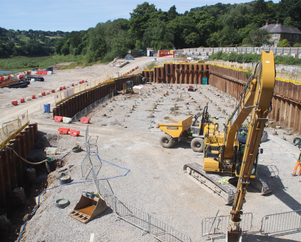
This is the start of the old Uttoxeter Canal: another 13 miles which once led on down the Churnet Valley to Alton, Rocester and Uttoxeter. And one day, the Canal Trust’s aim is that it will once again do so.


Image(s) provided by:
Martin Ludgate