Not actually a restoration, but a brand new waterway – albeit one first planned in 1812. But despite recent setbacks, there are signs that the time has come for the Bedford – Milton Keynes link to take real steps towards becoming a reality

Let’s get the bad news over and done with first. Earlier this year it was revealed that the widening to dual carriageway standard of a section of A421 main road just east of Milton Keynes wasn’t going to include building a bridge or any other provision for future navigation at the point where it crosses the route of the proposed new Bedford to Milton Keynes Waterway.
The response to this was a collective groan from much of the waterways movement to the effect that “well, that finishes off any chances that the waterway scheme ever had of getting built”. So I was half expecting the recent launch of the Bedford & Milton Keynes Waterway Trust’s ‘Marking the Route’ project (see news pages) to be a less than cheery affair.

But no. Although the Bedford & Milton Keynes Waterway Trust accepts that lack of provision for the canal at the A421 crossing is a major blow (albeit the fight hasn’t been given up yet), and that putting it right later will add a million or more to the eventual total cost of the new canal, the mood was far from gloom and despondency. And it’s not just about whether the waterway will ever get built, but about which parts of it will be built next…
But first let’s go back and look at the history of the idea. And it’s a long history, going back to when the idea of linking the River Great Ouse to the Grand Junction Canal (the original name of what is now the southern part of the Grand Union Main Line) was first proposed in the early 19th Century. The waterways are under 15 miles apart, and in 1812 engineer John Rennie carried out a survey for a canal between Bedford and Fenny Stratford. Five years later an alternative was suggested that would have linked Bedford to the Newport Pagnell Canal, which (until replaced by a railway in 1864) used to connect to the Grand Junction in what is now Milton Keynes. In 1823 yet another route was proposed, which would have reached the Great Ouse via its formerly navigable tributary the River Ivel,

Sadly none of these schemes came to anything. But following the restoration and reopening of the Great Ouse through to Bedford in 1978, thoughts eventually turned to the idea of whether a modern route could be constructed to fill the gap.
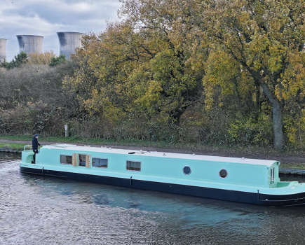
The attraction from a boating point of view was clear: as the crow flies it’s less than 15 miles between the two waterways, but by water it’s a roundabout route (only accessible to narrow-beam craft) via the Northampton Arm, the River Nene, the Middle Level Navigations, a short tidal passage at Salters Lode, and the entire length of the non-tidal Great Ouse. A nice trip if you’ve got the time, but a very long way round (probably taking between a week and a fortnight) to end up really not very far from where you started.

It was all demonstrated very graphically in the early days of B&MKWT’s plans by the convoy of lorries carrying narrowboats by road from Bedford to the Inland Waterways Association’s 2001 National Festival, completing this journey in less than an hour – and generating a great deal of TV, radio and press publicity for the idea.
But it isn’t just about spending millions on making the waterways network more convenient for boat owners. The route could help to popularise the under-used upper length of the Great Ouse; it could help regenerate an ex-industrial area of former clay quarrying and brick-making around Marston Vale (the lakes which would form part of the route are old flooded clay pits); it could tie in with plans for major new residential developments in this area, either by planning agreements requiring the navigation to be built as part of the housing scheme, or as a result of developers being attracted by the increased value of waterside housing. It’s these extra ‘outputs’ (in planning-speak) which turned the waterway from an attractive but unaffordable idea for canal boaters into something which could actually happen.

But could it? After all, in our last feature about the B&MK in our January 2012 issue, we looked forward to there being some actual canal channel construction later that same year – so six years on, have they been built? The answer is a qualified “No, but this time they really are about to be.”
To show that this mood of optimism isn’t just wishful thinking, we’ll start at the site of the ‘Marking the Route’ launch, at the Marston Vale Forest Centre. Here, a half-mile length of a narrow land drainage channel (which, it is proposed, will be enlarged to form part of the new waterway) linking Brogborough Lake and Stewartby Lake has been marked out with attractive wooden carvings featuring waterway themes (including boats and wildlife) which also double up has handy benches for walkers, cyclists and other people enjoying the Millennium Country Park that this section runs through.

This is the first part of a plan to put the waterway on the map, to raise awareness and support for the scheme along its length. But there’s more tangible evidence here besides the markers: an access road to a housing scheme crosses a new canal-sized bridge, and alterations to the nearby Station Lane which are made necessary by developments will also involve inserting a bridge to full navigable standards in the near future.
But there’s more. This is an area where around 5000 new homes are planned, in the form of three new villages. And the agreed Masterplan document requires lengths of the waterway to be built as part of the construction work in agreed stages over the coming years, taking advantage of its ability to form part of the area’s land drainage and flood precautions as well as having a future navigation role. All being well, this will result in the construction of the entire route between the two lakes, which together with the lakes themselves will create around five miles of the waterway – over one third of the total length.
Extending this length south westwards towards Milton Keynes will be a challenge: the waterway needs to climb the steep Brogborough Hill. Although a rather exotic ‘Brogborough Whirl’ spiral boat lift was proposed some years ago, some way of funding it (or alternatively a conventional flight of locks – which would be cheaper but less of a tourist attraction) will need to be found.
But looking in the opposite direction, the immediate prospects are brighter. Already, not far beyond where the route leaves Stewartby Lake, a new bridge built several years ago will carry the canal under the new dual carriageway A421 (making it even more infuriating that the same result couldn’t have been achieved regarding the A421 crossing at the Milton Keynes end). And the length between the lake and the bridge is to be paid for by the developers of a controversial power-from-waste incinerator and generating station, under a Section 106 planning agreement requiring them to provide £3,375,000 for waterway works including two road bridges, channel construction, and crossings for power cables.
Beyond the new bridge, the waterway will turn sharp right to run alongside the main road – and this is where in 2012 we promised that “within months” the Marston Vale Innovation Park (a new business park) would see a new length of waterway built as ‘balancing’ (flood control) ponds forming part of the land drainage. The economic downturn meant it didn’t happen anything like that quickly, but when we visited recently the earth-moving machines had just begun clearing the site, so this time it looks like it really will happen. Meanwhile on the final length approaching the Great Ouse, a residential development at Bell Farm looks set to create another section of waterway.
That’s not to say that getting the north eastern half of the waterway opened will be a case of simply waiting for all these schemes to be completed. There are lengths in between where there are no current plans or sources of funding identified. But it does look like some real physical progress will be seen in the next few years.
Meanwhile there has also been progress on the reaches of the upper Great Ouse between Bedford and the proposed junction with the new waterway at Kempsford. This is navigable with some difficulty depending on water levels and size of craft, but dredging is scheduled for later this year, and there are proposals for improvements to allow boats to reach the riverside Box End Park, a family leisure park just beyond Kempsford.
At the Milton Keynes end there is progress too. Sadly opportunities here were missed some years ago when it wasn’t possible to include canal construction as a condition for housing developments, and a bid for Big Lottery Fund money to create the first few miles from the junction with the Grand Union was narrowly beaten by other projects at the final stage. However the route (which makes use of Willen Lake and the Broughton Brook) has been identified and protected, and some bridges across it are already of navigable size. This is where the Marking the Route scheme is likely to head next, working with the MK Parks Trust to put the route on the map from the Grand Union at Campbell Park to the M1.
Finally, at the very start of the waterway at Campbell Park, there is some practical progress in the form of the first few yards which will form the junction with the Grand Union, and which is being built as part of a current residential and marina development. It really is just a few yards, but it creates the link with the existing canal, and will make it much easier to extend navigation into Willen Lake and on to the Broughton Brook in due course.
So there you have it: actual progress at both ends, and plenty more to come at various points in between.
B&MKWT isn’t kidding itself that the completion of the route is likely to be easy or quick. The housing developments cover a 35-year timeframe, although it is hoped that the associated waterway construction will happen much sooner. There are challenges including Brogborough Hill, the A421 and other roads. But hopefully the progress described above will indicate to the doubters (and I was one of them) that any rumours of the B&MK’s demise have been greatly exaggerated – and it won’t be too long before there is a significant amount of genuine construction work on the ground to demonstrate this.
Image(s) provided by:
Martin Ludgate