The Wey & Arun Canal has been under restoration for a long time, but it’s making progress all along the route – and there’s the prospect that in the not too distant future visiting boaters might be able to cruise the first length…
Heading south from the Wey
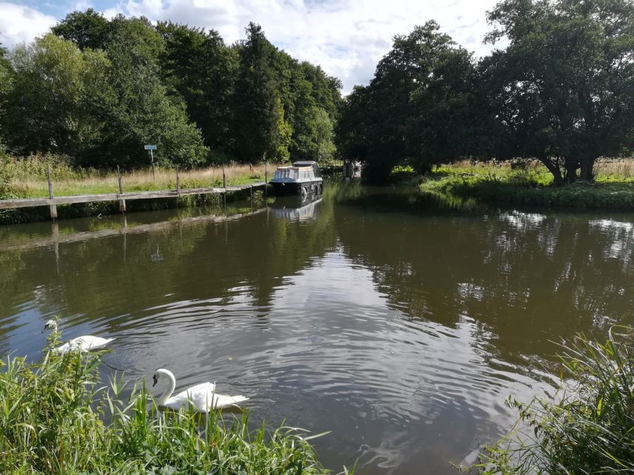
A couple of miles upstream of Guildford on the River Wey, a rather enticing-looking side channel leads off south eastwards from the river, with a handful of boats moored on it. A sign alongside it proclaims that this is the junction with the Wey & Arun Canal. Many boaters will have passed it and wondered if and when they would ever get to cruise the former link through to the River Arun and the South Coast, last navigable in 1871. And they’ve been wondering that for quite some time, because the canal’s been under restoration since the 1970s. And although in recent years there’s been a fair amount of tree and vegetation clearance on the first length, there hasn’t been any new water opened to navigation beyond the moorings at the junction.
Gun’s Mouth: entrance to the Wey & Arun Canal from the River Wey
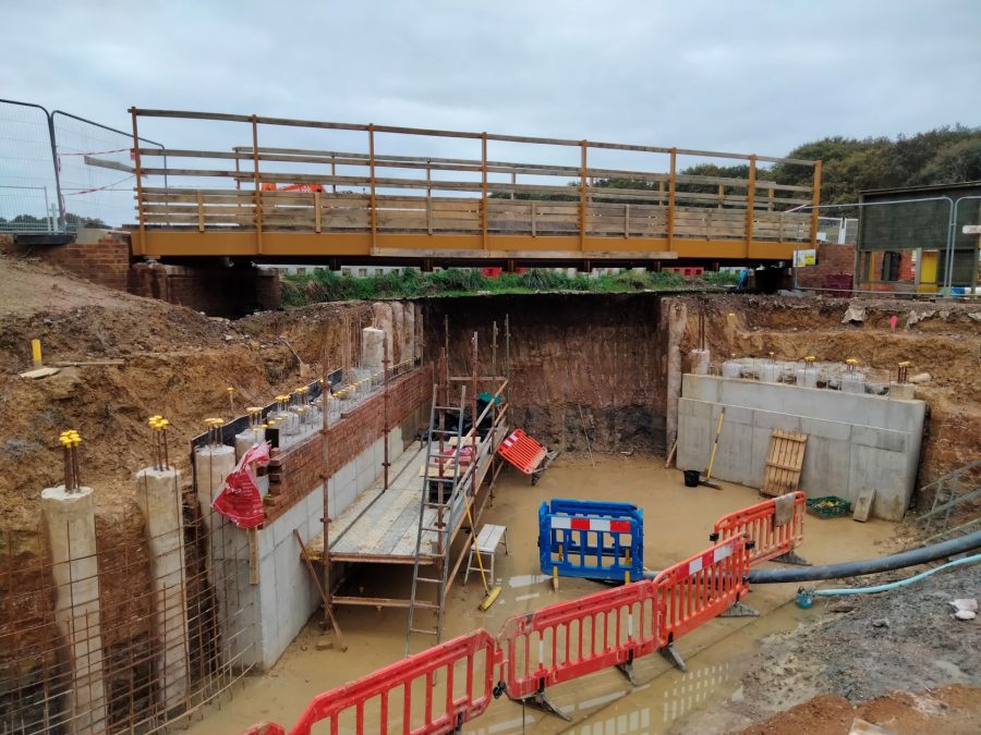
By now, if you’re a regular reader of Canal Boat magazine’s canal restoration articles, you’ll be expecting yet another explanation from the author of how and why – despite the undoubted popularity that reopening even the first couple of miles of this rural backwater of Surrey and Sussex would enjoy with visiting boaters – it unfortunately makes more sense for perfectly reasonable (if utterly frustrating) reasons to instead concentrate on restoring an isolated length some miles away. However, for all that that’s been the case for the last 40-odd years (for an assortment the usual reasons involving funding, planning, and tackling the parts of the canal that have survived in the most restorable condition first), it’s no longer true here. At some point in the next few years there is every likelihood that the first short length will reopen to navigation as a branch off the Wey.
Sure, it won’t go very far, and it won’t come very cheap – and that’s why it’s taken until now to start work on it. But it will be a step in the right direction. Not only that, but the Wey & Arun Canal Trust believes that a successful and popular reopening of this length will pave the way for a lot more. WACT estimates that ‘Phase 1’ (it seems you can’t be a proper canal restoration these days if you don’t have phases!) reaching for about a mile from the junction with the Wey (known as Gun’s Mouth) to just past the second road bridge at Tannery Lane, about a mile away, will cost £3.5m.
That may sounds a lot for a short length (and for a canal society to raise). But bear in mind that since the canal shut (as long ago as 1871) parts of this length have been obliterated, the A281 main road bridge has been culverted, at Tannery Lane the original canal arch is unavailable, and in places the canal needs to squeeze alongside the Downs Link – a walking and cycling trail based on a disused railway. There will need to be new lengths of channel, a new lock, and diversions to use different bridge arches – the spans taking the A281 over the Cranleigh Stream, and Tannery Lane over the former railway. But on the plus side the new canal won’t just be a navigation, it will be a local asset that complements the Hunt Park created in recent years with support from WACT. And as regards raising the cash, bear in mind that some years back WACT successfully raised £2m for its project to build a new road bridge, build a new lock, and rebuild an existing lock at Loxwood (see below). And there is hope that use of volunteers will bring the cost down significantly.
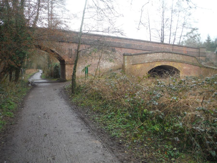
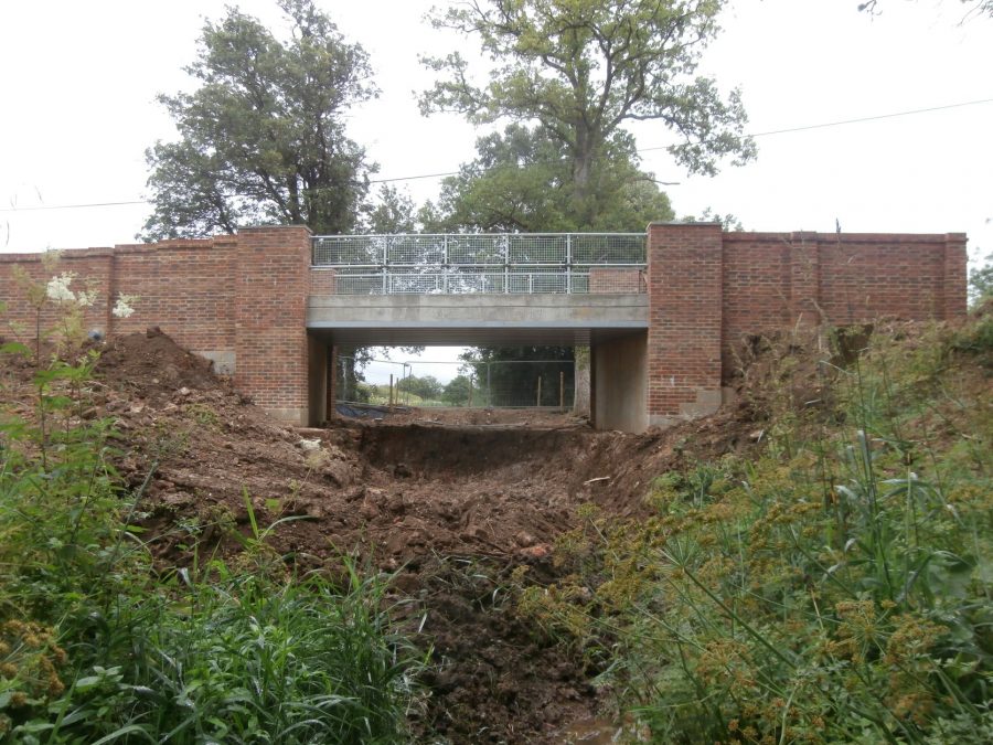
At Tannery Lane Bridge the restored canal will use the former railway span on the left
Some details of this length are still to be worked out as part of a continuing consultation with the local residents which has been taking place for many years and there are planning consents to be considered, so sorry, no predictions yet for an opening date!
And on to Bramley
You will be unsurprised to hear that Phase 1 will be followed by Phase 2. This will be a shorter length continuing beyond Tannery Lane to Station Road, Bramley village. It does include one interesting feature: Gosden Aqueduct. It isn’t a particularly impressive structure – it’s really a series of culverts carrying the Cranleigh Stream through a low embankment – but it’s the only surviving original aqueduct on the canal. And its restoration will extend the canal to give visiting boaters their first proper ‘destination’ in the form of Bramley village.
Unfortunately it then gets more difficult: part of the village has been built on the canal route. In the past, options for restoration have included diverting via the trackbed of the old railway, a canalisation of the stream, or a new route along its banks – all of them with complex issues to resolve. So for now, we’ll skip that section and look at the next length under active restoration.
A brief aside: a few years ago, the Trust launched its “Three Sites” initiative: branching out from its main active restoration project at Loxwood to tackle two more lengths – the section we’ve already described at the north end, and another length on the canal’s Summit Level near Dunsfold. Well, that’s now been superseded by what’s more like a seven-pronged attack, as WACT teams have found the resources to tackle lengths spread out along the line. The idea is that a kind of ‘pincer movement’ will then (hopefully) see opportunities to link these lengths together in the longer term.
The first of the two Birtley liftbridges under construction during a series of volunteer camps in summer 3019
Birtley’s bridges
And the next of these length is at Birtley, just the other side of Bramley. Here a section of rural canal survives intact, and a project has been under way to open up the towpath and link it with local routes to form a network of footpaths. Two of these will cross the canal – and that means two new liftbridges, which in turn will enable existing farm crossings blocking the channel to be removed so that in time this section can be reopened to navigation. In 2019, the fixed parts (i.e. everything except the deck and lifting mechanism) for the first of these new liftbridges were built – largely in an epic three-week period of volunteer Canal Camps, with visiting teams of mobile volunteers from Waterway Recovery Group and NWPG supplementing WACT’s own group to achieve a tremendous amount of work. More recently the deck has been built and installed, and the volunteers are looking forward to installing the lifting gear – as well as cracking on with the second bridge in 2023.
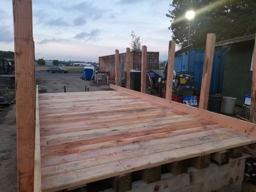
The completed deck ready to be installed on first Birtley liftbridge
Less than a mile beyond Birtley is Rushett, and here the proximity to the old railway might be a benefit for the canal. A new canal crossing is needed for a farm track / bridleway, and the railway bridge still stands – so the idea is to squeeze the canal through alongside the Downs Link. The canal will continue on a new route alongside the old railway (which will be more straightforward than reinstating its original course) for the next mile, including passing under another bridge which carried a road over the railway. A planning application has already been submitted for the new canal route.
The next area of interest is a couple of miles further south where the B2130 Elmbridge Road crosses the canal – and this could have been a major challenge for restoration. But in fact the narrow section of road – restricting it to single-lane traffic – has created a bottleneck for road users which Surrey Council has already identified as a priority for dealing with. And the necessary road widening looks likely to happen as part of a combined scheme to also reinstate the missing canal bridge and build a new lock (replacing an original one further north) to allow the road to cross the canal with navigable headroom and without needing a raised bridge.
To the summit…
The new lock will raise the canal to its summit level, which meanders south westwards to reach Fastbridge, where the A281 main road is carried across the channel on an embankment. Once again WACT is hopeful that this will be replaced with a new bridge at some point – although unfortunately it may have missed the chance to happen as part of the construction of new access roads to the Dunsfold Park development on the site of the former Dunsfold Aerodrome.
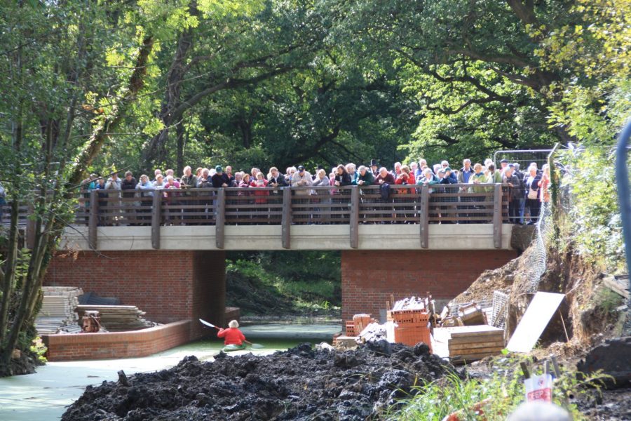
Flashback to the official opening of Compasses Bridge by Dame Penelope Keith in 2016
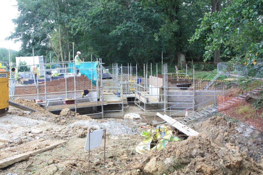
This marks the start of the restored part of the summit level, where the new Compasses Bridge was opened a few years ago, followed by a new slipway enabling trailboat events to take place. The restored section ends at Tickners, where another (smaller) road blocks the canal – and replacing this blockage is another of WACT’s current plans. It will be a repeat of Compasses Bridge in that it will combine a basic structure build by contractors with a great deal of ancillary work (brick facings, parapets, towpath and wing walls) added by volunteers. Where it differs from Compasses Bridge is that the canal needs being diverted to make the necessary raising of the road level more manageable. The first stage, the associated foot / bridleway bridge, has already been built. And the main bridge structure is planned for the coming years. A sensitive length follows as the summit ends and the canal descends through the Sidney Wood lock flight, with an initial dialogue under way between WACT and Surrey Wildlife Trust regarding options for reopening.
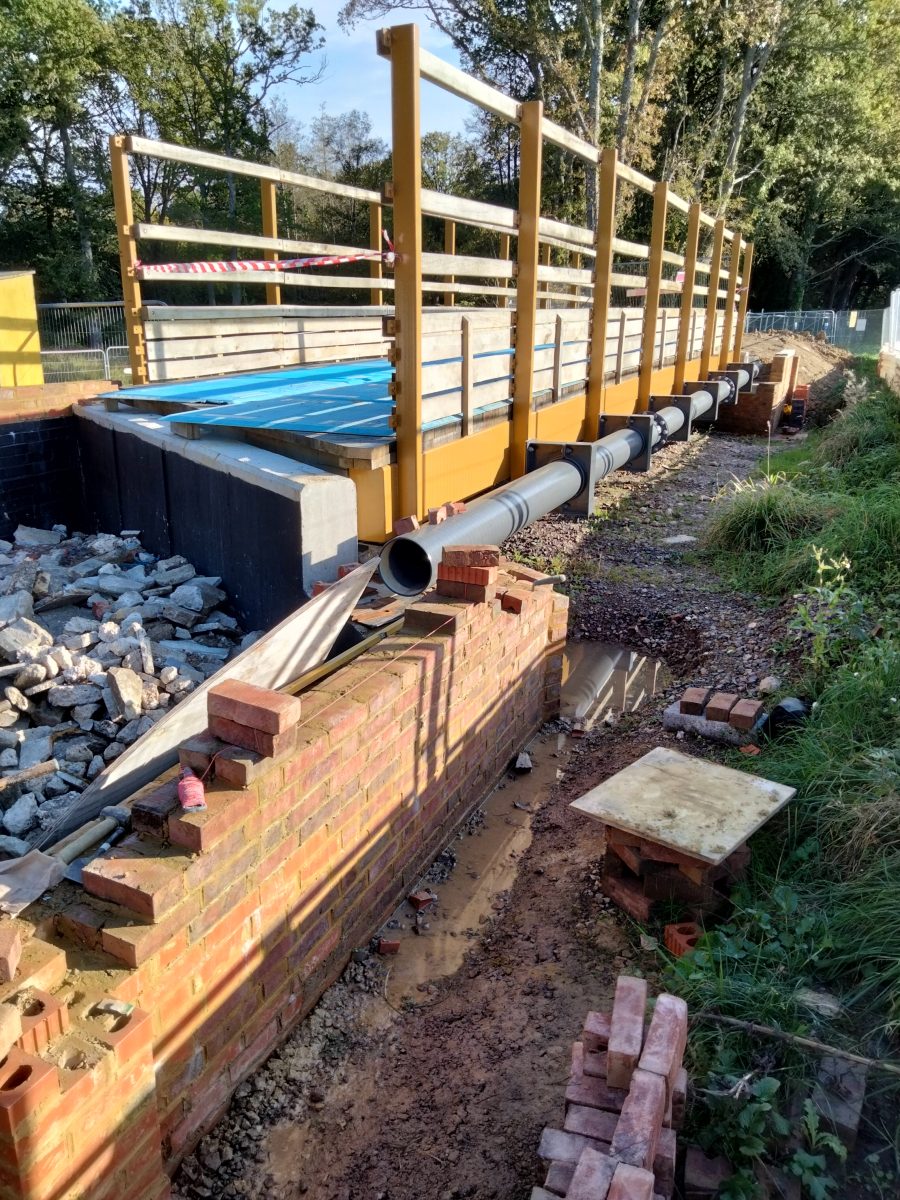
First stage of the Tickners bridge construction project – the footpath / bridleway bridge
A four-mile showpiece length
At the foot of the flight, having incidentally left Surrey for Sussex, we reach Gennets Bridge Lock and the start of the ‘Loxwood Link’, the longest restored length on the canal. This showpiece length totals not far short of four miles, with two reinstated road bridges (including the B2133, rebuilt a decade ago at a cost of around £2m), six restored locks plus one new lock (added to allow an acceptable road level over the new bridge), and a reinstated aqueduct over the River Lox – and it’s the base for WACT’s popular trip-boat operations.
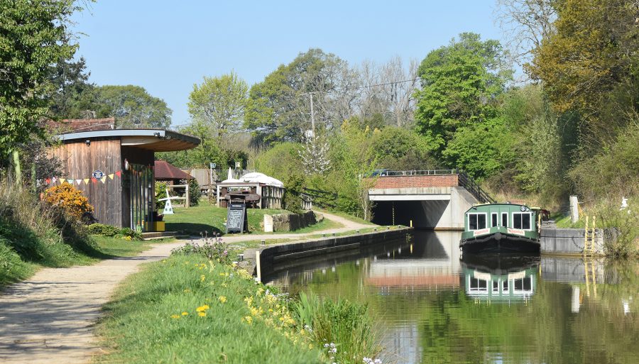
Base for the Wey & Arun Canal Trust’s trip-boat operation on the four-mile restored Loxwood section
The navigable length ends just past the restored Drungewick Lock (which incidentally was showing signs of ground movement recently, but has been successfully stabilised with a novel technique using ‘Platypus Anchors’ – believed to be a world first for use of these on a canal), but it’s only a mile and a half to another restored length – this time almost two miles long – including Malham and Rowner Locks, Bignor Bridge, Loves Bridge and Newlands Lift Bridge. It ends, once again, at a main road blockage which looks set to be replaced with a new bridge as part of major road works in the not-too-distant future to remove a traffic bottleneck. Unfortunately, though, rebuilding the A272 at Newbridge has been ‘in the not-too-distant future’ for about the last four decades, so it may take some time yet…
Heading south for the Arun
We’re now onto the southernmost length of canal, historically built as part of the Arun Navigation. However from a practical point of view it’s no different, having been built as an artificial canal parallel to the river – and crossing it at Lordings, on an interesting structure consisting of an aqueduct leading directly into a lock, accompanied by a waterwheel raising water supplies from the river into the canal.
The aqueduct has been restored as a historic feature, but it won’t function as an aqueduct, because at some time after the canal was abandoned the river has been diverted to cut through the canal channel just below the lock. But recent initial clearance of the lock chamber indicates that the levels would be suitable for the two watercourses to cross each other on the level. Also while there is some damage to the brickwork, the lock is in a restorable condition. And a short distance downstream, a turf-sided flood lock (presumably built to cope with river water overflowing into the canal in times of flood) has been restored, and will prevent water levels fluctuating with river levels in the next length.
This is the start of a length where a great deal of restoration has been achieved over the years – and could be linked up in the medium term. WACT’s latest completed project, Harsfold Bridge carrying a bridleway over the canal, is followed by Haybarn swingbridge (restored almost 20 years ago) Lee Farm Lock and stream culvert (rebuilt in the 1980s and 1990s), and Toat Bridge (built new in the 1980s).
Harsfold Bridge, completed in late 2020
Just two bridges remain to be completed: Lee Farm Bridge (where planning for rebuilding is under way, and permission has been secured) and the second is Pallingham Bridge, the very last on the canal, where restoration of the historic brick structure by a WACT volunteer team (once again using Platypus Anchors to stabilise it) is almost complete.
And from there, a two-lock staircase (currently very derelict and with no immediate plans for restoration) descends into the Arun, with 20-odd miles of navigable tidal water leading to the English Channel.
As you can see, there’s still a great deal to be done, but the Wey & Arun had moved on a long way from having a single main restored length at Loxwood and a number of smaller projects elsewhere on the route. None of the restoration sites described above are more than a couple of miles from the next one in either direction. Call it a ‘pincer movement’ or the more friendly-sounding ‘joining the dots’, but there will be progress in linking these lengths together in the coming years. And in the meantime, that sign at Gun’s Mouth Junction could lead to a short navigable excursion off the River Wey before too long.
To find out more about the Wey & Arun Canal restoration, how to join the Wey & Arun Canal Trust or how to volunteer on the canal, click here