Ditch the boat and follow the footsteps of King Offa along the ancient earthworks which created Welsh border country. Daniel Parry set out on a four-hour foray in the hills

The Ceiriog Valley is often overlooked by visitors to north-east Wales due to its proximity to the Dee Valley, which is more dramatically situated.
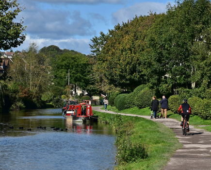
Telford’s Chirk Aqueduct, beside Stephenson’s Railway Viaduct, would be the jewel in the crown of the UNESCO World Heritage Site that runs for 11 miles from Horseshoe Falls to just round the corner at Gledrid Bridge, that makes the Llangollen Canal so special, if it weren’t for Pontcysyllte Aqueduct, 120ft over the Dee. But the narrow green course of the Ceiriog Valley running out of the Berwyn Hills towards the Cheshire Plain has an evocative charm all of its own.

Moored at Chirk Bank, and about to head east on our narrowboat and leave it behind for a while, we decided to further explore some of the valley.
Our walk started at Chirk Bank, on the Shropshire side of the valley, where we turned west off the road through a kissing-gate, following the signs for the Shropshire Way. Our route took us onto a field high above the canal, and then over the railway track. From the next field we climbed over a stile and onto a muddy path at the top of a steep and wooded slope down to the river, which descended gradually to a road. Under the hedges were sprinklings of pure-white snowdrops.
At the junction (where we turned right) was a farmyard with a herd of Welsh Section-A ponies. The woman we spoke to told us that they recently won gold at the Royal Welsh.
At Pont-Faen Bridge we continued west and into the valley alongside the river. The hills squeeze the valley to a bottleneck here, the wooded slopes rising steeply on each side. It was easy to see how foolish it was of Henry II to march his army this way into Wales in 1165. Somewhere here they were ambushed by a coalition of Welsh princes and a bloody battle – Crogen – ensued in which the English were defeated and Henry almost lost his life before the Welsh melted back into the hills.

Walking along the edge of the shallow and stony river we saw yellow wagtails and dippers flitting. Trout farms run along beyond the far bank. Then we were amongst the ashes and hazels again, climbing steps up the fern-strewn slope. Streams tumbled over smooth stones down the hill. The air was alive with birdsong.
We came onto a lane, climbing steeply south past a farm and onto a road, where we headed west towards Offa’s Dyke. Taking a track beside an old schoolhouse we emerged onto a field at Bronygarth and got our first glimpse of Chirk Castle, peeking above the trees on the other side of the valley. The last Edwardian fortress in Wales, built to command the valley, it was finished in 1310 by Roger Mortimer, Lord of Chirk, gifted the area for his part in the conquest of Wales three decades before.
We were above the site of a disused quarry, trees standing where the stone was worked. Here, we met a couple of bold piebald ponies who came to say hello. We turned to look east and the view into England extended into the flat and blue distance. This has always been a frontier for men, and you can see why – where the plain meets the foothills. Soon we reached Offa’s Dyke – the western frontier of Anglo-Saxon Mercia – and stood on it looking at the green Berwyns. It’s not often you get to stand on an 8th-century earthwork – the longest in the UK. (No engineering project would be attempted on such a scale for more than a millennia, until the advent of the canals.) Offa started into the foothills, it seems, before stopping in the realisation that to go any further is to enter a different country in more ways than one, decided this was far enough, and drew his earthen line. The land decreed it. He gave Wales its first tangible border, forever defining the identity of the Welsh. It corresponds remarkably with the current national border. Once it would have been a great rampart with a deep ditch on the western side, but it’s no longer impressive, as one might expect for such a famous structure, being just a short bank with a line of hawthorns along it. Yet it still hums with ancient energy. Of the 177 miles of the Offa’s Dyke Path, from Prestatyn to Chepstow, this section, from Froncysyllte to just south of Oswestry, is one of just three that follows the line of the dyke itself – some 80 miles in total.
We turned north and headed into the valley. A number of houses sit right on the dyke, or where it once was, distressingly, descending to the valley. Thankfully, it is now a scheduled monument. We crossed the river (and the frontier) and climbed a steep track up the north side towards a farm called Crogen Wladys, skirting the edge of some coniferous woodland. Climbing beyond the farm we slowly made our way to the top of the hill, between woods, passing crumbling dry-stone walls and a tumbled oak tree, feeling the ache in the thighs, stopping regularly to catch our breath. We turned to regard the view. The hills were of smooth green fields, grazed by sheep, climbing to humps rather than peaks. Lonely farms and patches of woodland were scattered. We could see the wending course of the river from the west.
At the top the land evened out to a plateau and gave us views far to the north and east, fading to a sky-coloured haze. There’s something about such a long view, apparently reaching to the ends of the world, that touches the heart. Wrexham was visible. The Kronospan factory at Chirk billowed plumes of steam. To the east we looked down on the castle, with its round towers and curtain walls, not quite grand but squat and imposing, as if in confrontation with the surrounding land. A flock of black Welsh mountain sheep scattered as we approached.
Continuing north we came to the road, which took us in a broad eastern arc back to the south side. We passed a field of English Longhorn Cattle and some magpie cottages. After the varied terrain of the valley it was a comfortable stroll that took us back over Offa’s Dyke and round to the baroque white gates of the castle. Past the adjoining caravan site to the road, we crossed Chirk Aqueduct, back into Shropshire, and came back to the boat four hours after we left it.
Image(s) provided by:
Archant